Making Your Listings Stand Out Above and Beyond.
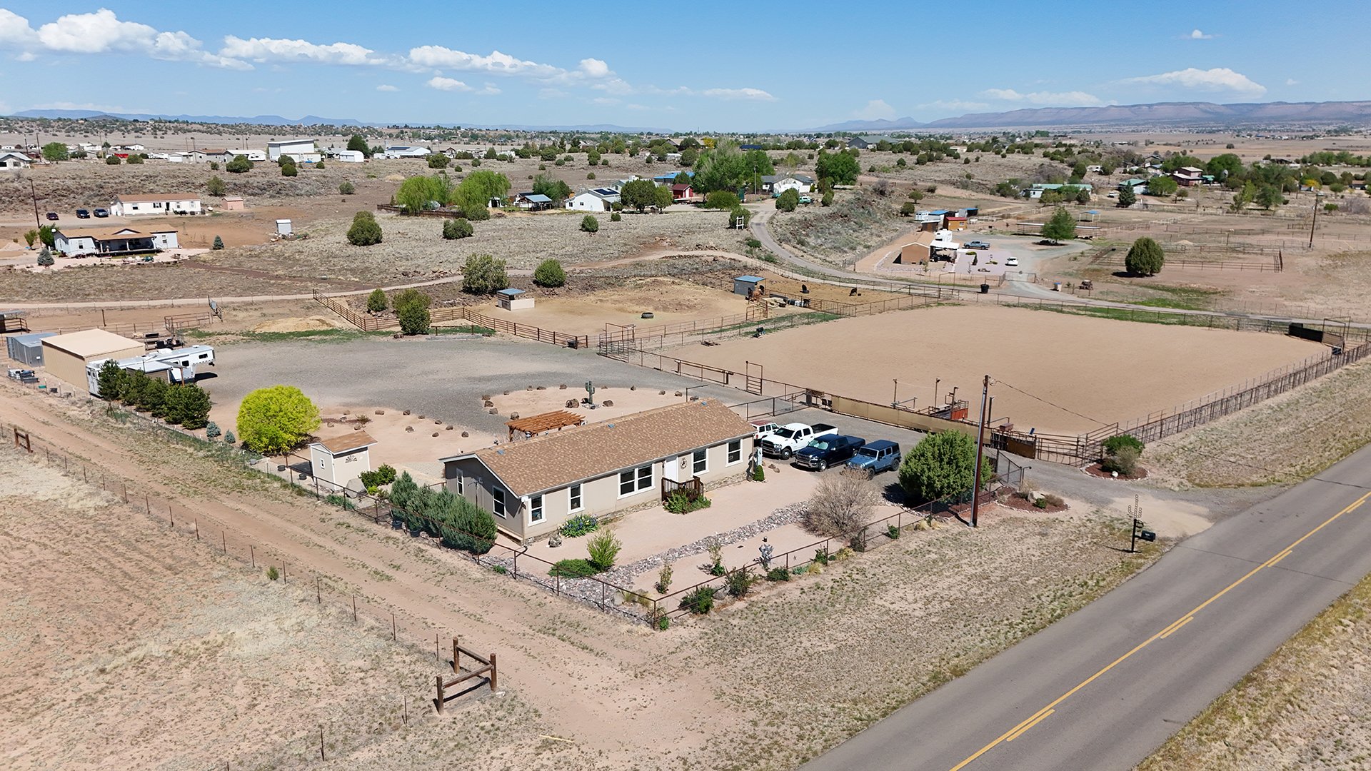
Aerial real estate photography has become an essential tool in the marketing arsenal for real estate professionals. Utilizing drone technology, this specialized photography captures properties from unique and striking angles, showcasing the entirety of a listing in ways that traditional photography cannot achieve.
We Are Certified FAA Part 107 Drone Pilots. We will schedule drone services according to the weather only when it’s safe to fly.
By providing high-resolution images from above, aerial photography allows potential buyers to fully appreciate the property’s scale and surroundings. It highlights key features such as expansive backyards, proximity to local amenities, and surrounding landscapes that add value to the listing. This bird's-eye view also helps in demonstrating the layout of large estates, condominiums, or commercial properties, making it easier for buyers to envision themselves within the space.
In addition to enhancing the visual appeal of listings, aerial photographs can depict intricate details of the surrounding neighborhood. This contextualization informs prospective buyers about the community, nearby parks, schools, and other features that may not be readily apparent from ground-level images. When done professionally, aerial photography not only elevates the quality of the real estate marketing campaign but also enhances brand visibility and sets listings apart in a competitive market.
Real estate agents are increasingly using this powerful imagery across multiple platforms, including online listings, social media, and print materials. As homebuyers increasingly utilize digital channels to search for properties, the integration of aerial photography proves to be a strategic advantage.
For those considering aerial photography for their real estate ventures, it’s crucial to work with certified drone operators who specialize in this field. They understand the regulatory requirements and can ensure that the images are captured within safe and legal frameworks. Professionals should also pay attention to factors such as optimal lighting, time of day, and seasonal changes that can affect the quality of the photographs.

Roof Aerial Photos / Roof Inspections Photos
Roof Aerial Photos & Roof Inspection Photos
The Importance of Aerial Photography for Roof Inspections
Aerial photography has revolutionized the way roof inspections are conducted. Utilizing drone technology, roof aerial photos provide comprehensive, high-resolution images of roofs that traditional methods cannot achieve. These photos allow for a detailed examination of the roof's condition, helping to identify issues such as leaks, damaged shingles, and wear caused by weather or time.
Benefits of Roof Aerial Photos
Comprehensive Coverage: Aerial photos cover hard-to-reach areas, providing a complete view of the roof’s surface.
Enhanced Detail: High-resolution images capture minute details that may be overlooked during ground inspections.
Time Efficiency: Aerial inspections are quicker than traditional methods, reducing labor costs and minimizing disruption.
Safety: Drones eliminate the need for ladders and scaffolding, significantly reducing the risk of accidents during inspections.
Roof Inspection Photos
In addition to aerial photographs, detailed roof inspection photos taken from various angles contribute to a thorough assessment. These images are crucial for:
Documentation: Providing a visual record of the roof's condition at the time of inspection, useful for warranty claims or future reference.
Analysis: Assisting roofing professionals in identifying problem areas and planning necessary maintenance or repairs.
Client Communication: Offering clear visuals to clients, helping them understand the condition of their roof without requiring technical jargon.